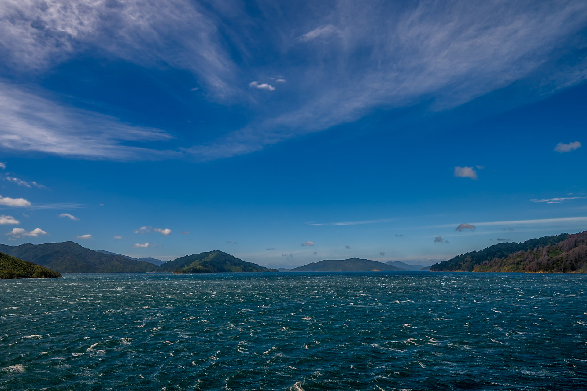
Having spent the last week in the north part of the South Island, it was time to start making our way south. There are limited opportunities to move between the east and west coast over the South Island due to the mountains running down the spine. We had decided to take the west coast route to begin with, allowing us, hopefully, to do a heli- hike onto one of the glaciers. This meant quite a long drive from Saint Arnaud. We did think initially about stopping in Greymouth, however in the end decided to stop in the small town of Blackball, about 20 miles short of Greymouth.
On the way down, we stopped briefly in the town of Murchison. We stopped primarily to get some bits from the supermarket, but had a quick walk around the town, and saw what appeared to be a very popular cafe, in what appeared once to have been a petrol station. There were tables in the forecourt, and what presumably was originally a small shop had tables and the food counter. We had some extremely large and impressive burgers, with much more vegetable than meat, but both extremely nice.
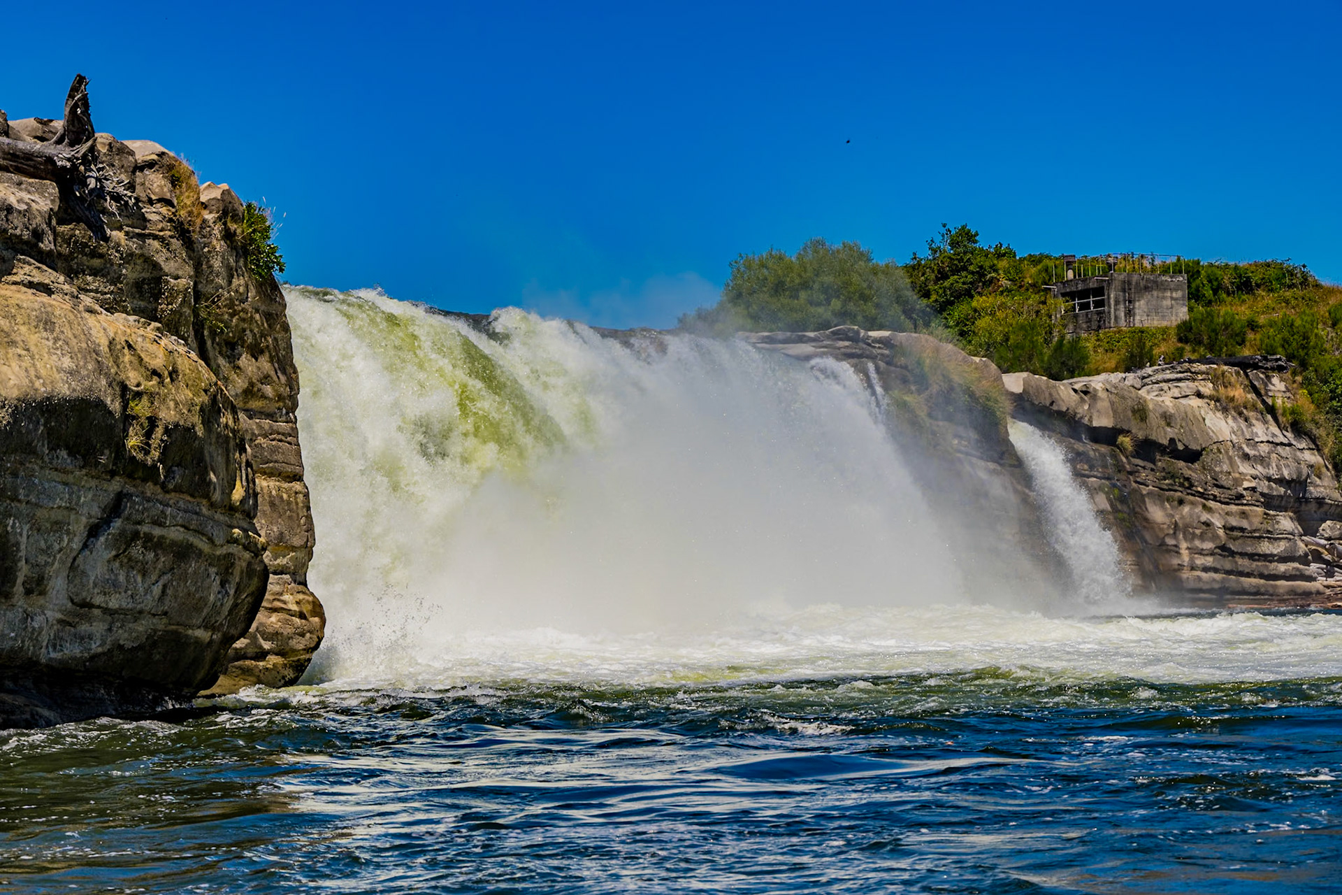
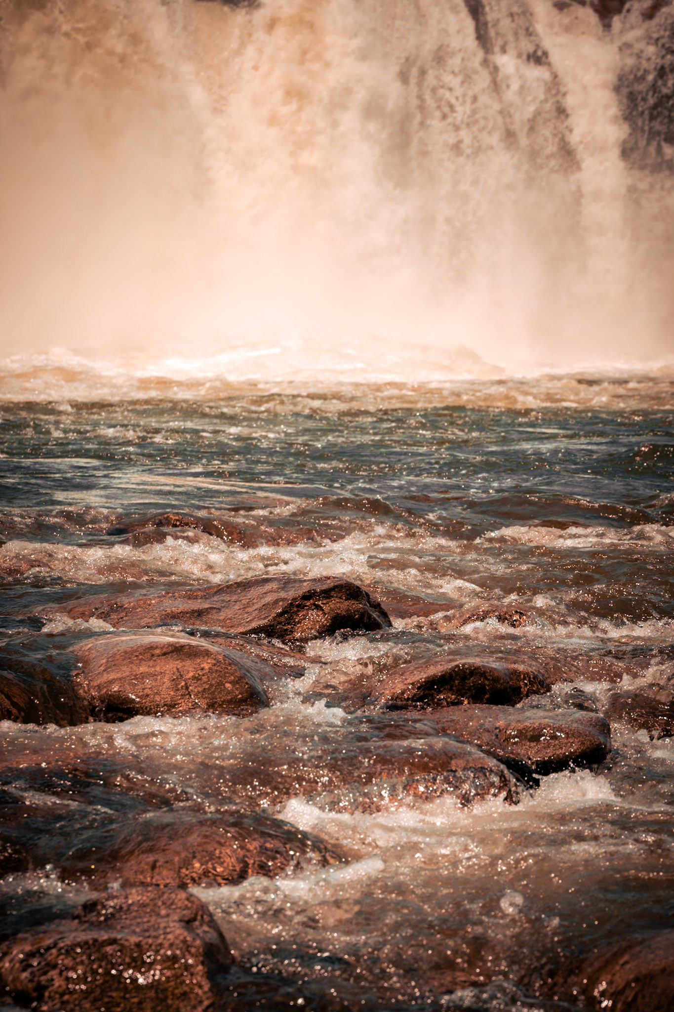
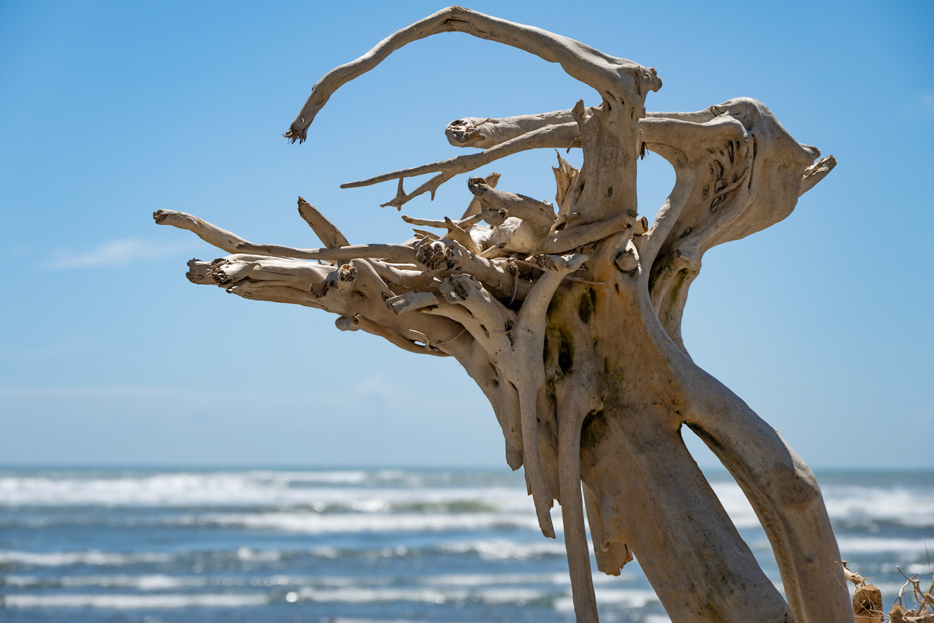
Our next stop was Manuria Falls, a waterfall that was quite different from any other that we had seen, being not very high but very wide. Even in the relatively dry season, there was a lot of water pouring over the falls. However, it was clear that when the winter snow has melted, the falls would be even more impressive, judging by the dead trees that had been deposited previously.
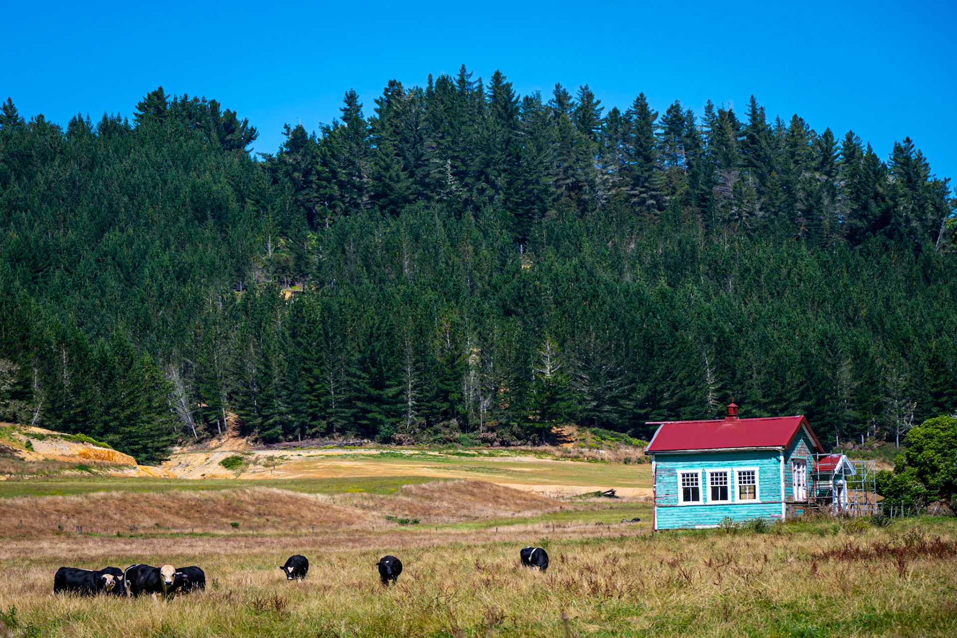
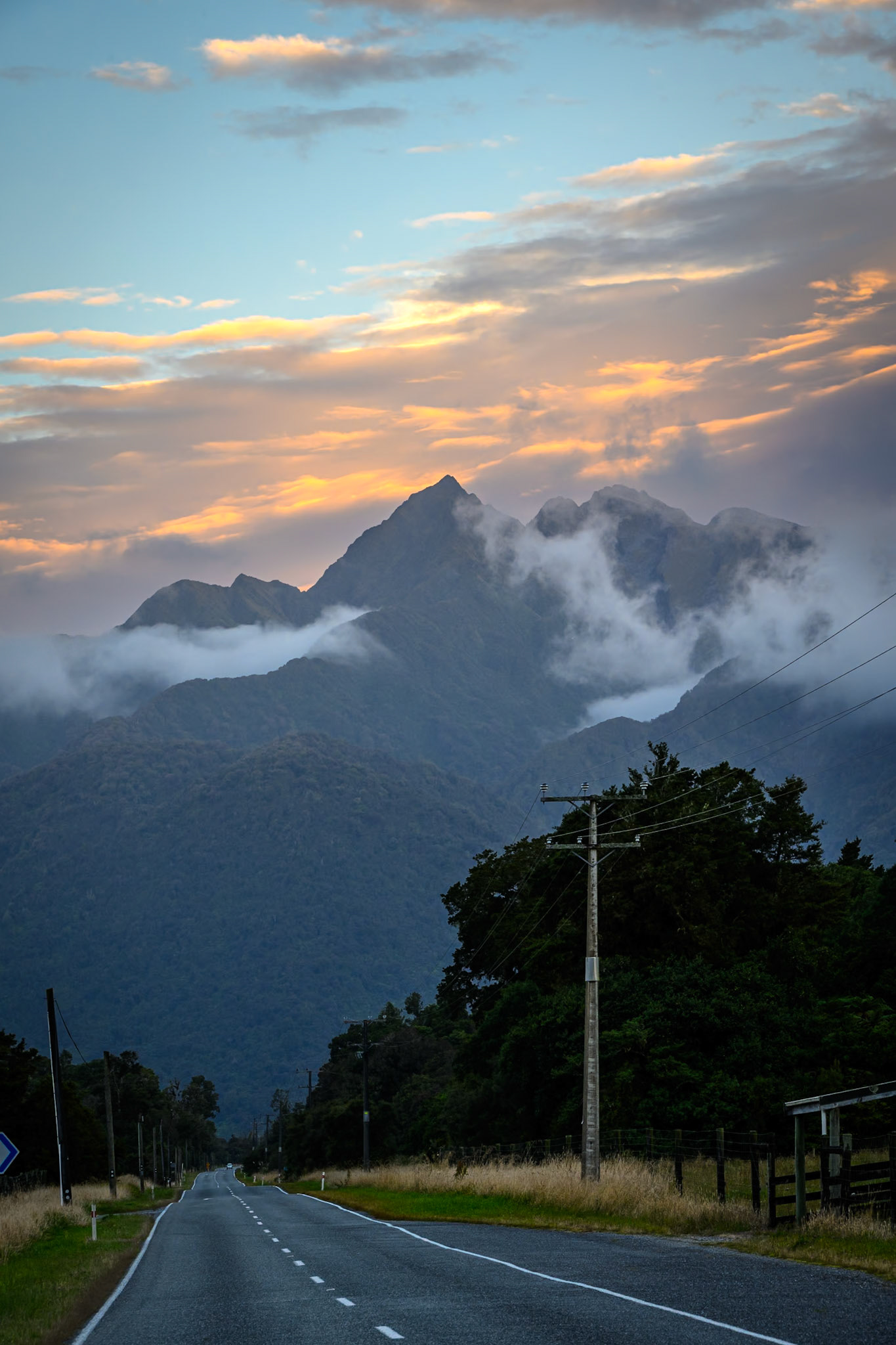
The road on was very pretty, albeit with lots of tall trees on both sides of the roads meaning that glimpses of the mountains were few and far between, making them all the more impressive. We then saw a sign for a ghost town, Waiuta, and decided to pay a visit. Little did we know when we turned off the road that it would be more than 10 miles along twisty, narrow, gravel tracks. When we got to the town, which at one time had around 500 residents mining gold from the start of the 20th century through until 1951 when the mine collapsed, we found that not only did the residents leave almost overnight, but generally took the buildings with them. Some people we spoke to said that their friends now own what was once the Catholic Church, which had been dismantled and taken away from the town in the early 1950s, and which had then been moved a couple of times and is now an Airbnb. To my mind, this was no longer a ghost town, it was an ex mining town where virtually everything had been taken away.
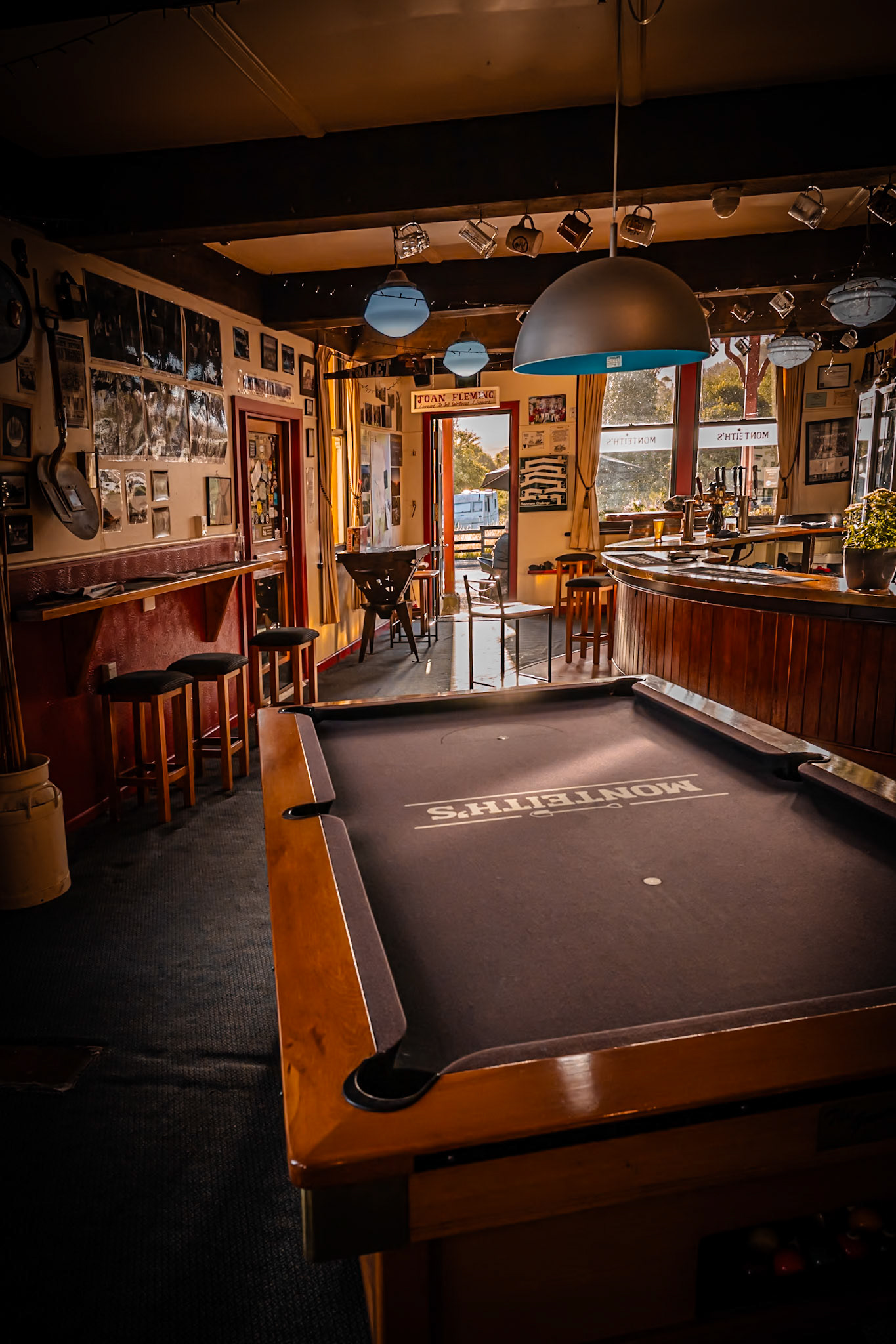
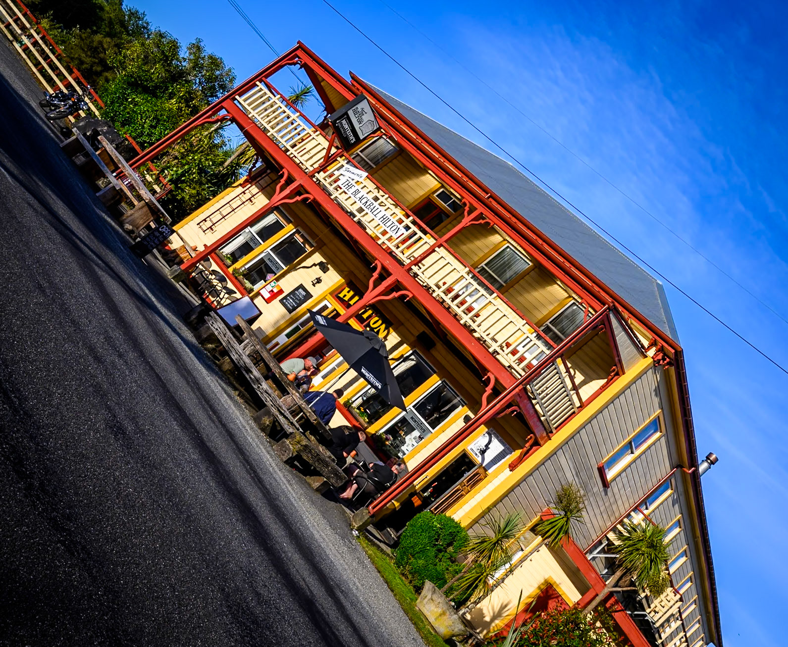
As it turns out, Blackball where we were staying for the night is also an ex gold mining town which, by rights, should have gone the same way as Waiuta. However, the town has survived, and there are certainly a few characters around making it a character full town. The hotel slash restaurant, the Blackball Hilton (apparently nothing to do with the Hilton chain of hotels) was full of character, and I was approached on an early morning walk to grab some photos by a guy who wanted me to confirm that he was looking at two ducks as he had never seen ducks in Blackball before. If you want to get an idea of what the town was like, think Twin Peaks and you won't be far off.
Although we did not realise it until we were charged a 15% ‘national holiday’ surcharge, the next day was Waitangi Day, the anniversary of the day in 1840 when Māori chiefs signed an agreement for British sovereignty.
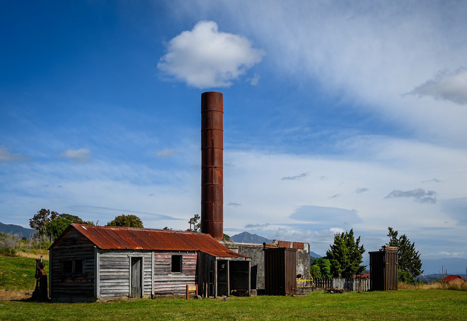
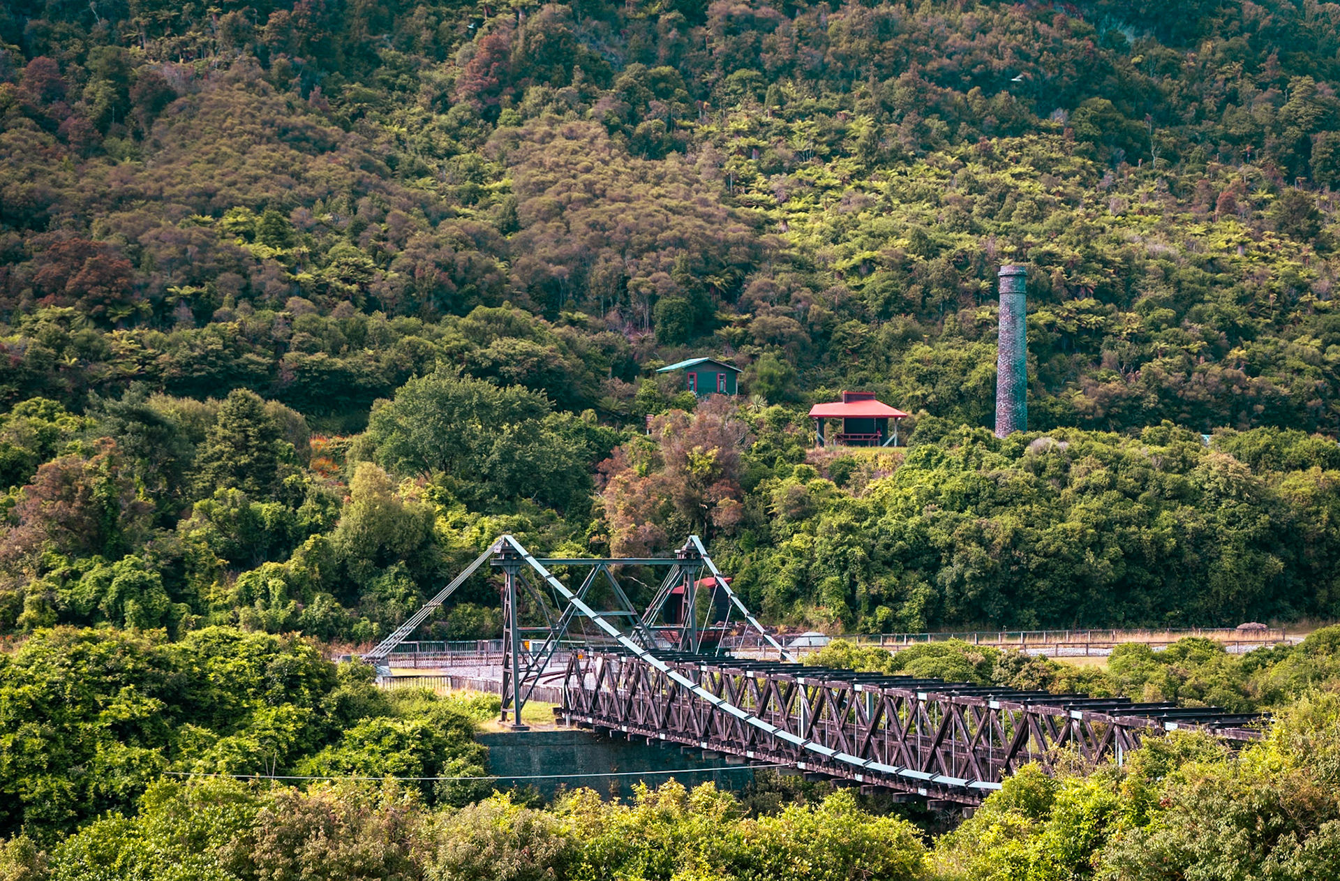
From Blackball we headed across towards Greymouth, but on the way made an unplanned stop at the old Brunner mine. Back in the late 19th century, there was an accident in the mine which killed all of the miners. One of the most interesting parts of this story was that on the day of the explosion, the pit ponies had refused to go underground, and in the end needed to be blindfolded and walked in backwards to get them underground. It seems that perhaps they had been able to sense the buildup of gases in the mine which late to the explosion. The relatives of those who died pressed for compensation from the mine owners. They were eventually successful in doing so, but then largely had to leave the community as they had affected the profitability of the mind company at the expense of all the miners that followed them.
We then made our way down towards Franz Josef where we hoped to go on a glacier. We almost missed our accommodation for the night. Knowing that we were heading towards Franz Josef, which is along a single road down at the east coast, we did not put the accommodation details into the satnav. We stopped for petrol a little bit short of Franz Josef, and at that time put the address into the satnav. That showed we were 380 metres from our accommodation, which we had just passed. It was a good job we had to put the address in then and not continued into Franz Josef as we were able to just turn around and check into our room for the next two nights- an old maternity hospital which, at least judging by the bathroom, still had many of its original features.
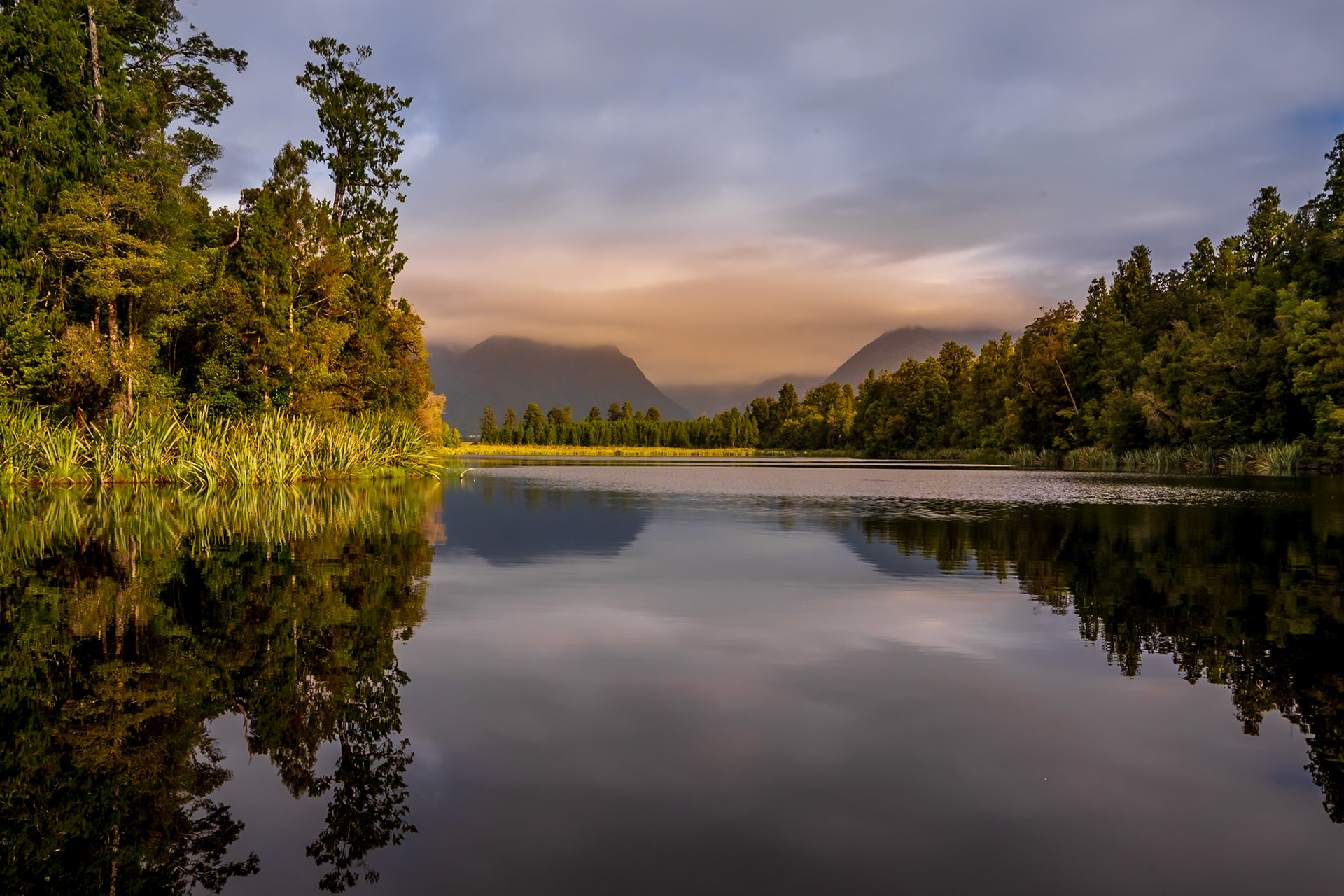
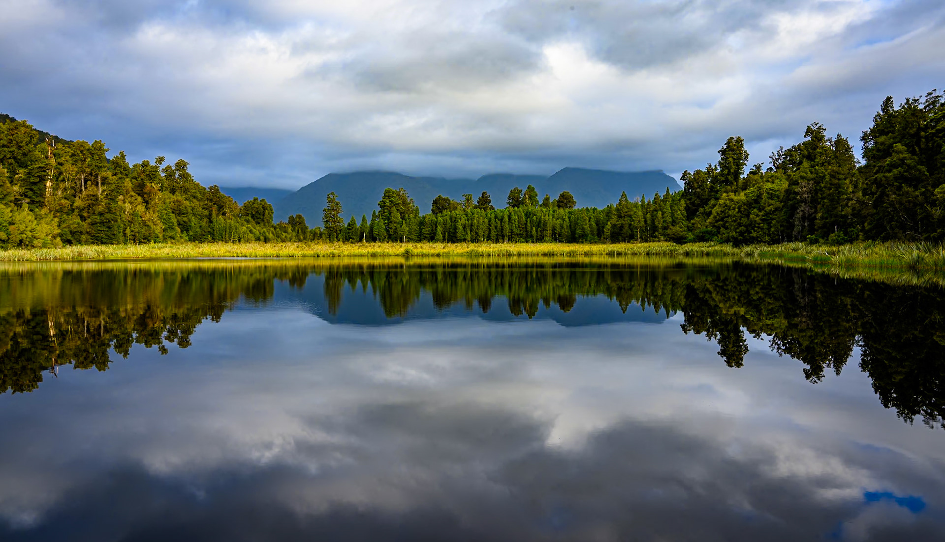
The town of Franz Josef, and the glacier sitting above it, was about 20 minutes drive away, with the Fox Glacier a further 20 minutes on. We had seen that there was a lake near the Fox Glacier that was supposed to give very good reflections of the mountains, including Mount Cook. We therefore first headed to see where we would be picking up our helicopter for the glacier flight the following day, and then headed down to the lake. There was some very nice reflections, but unfortunately not of Mount Cook which was hidden behind banks of cloud.
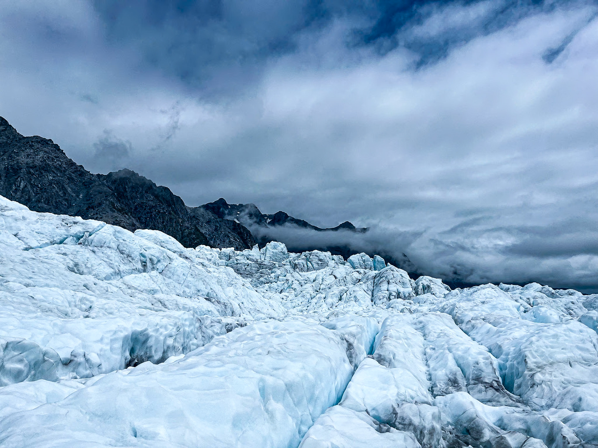
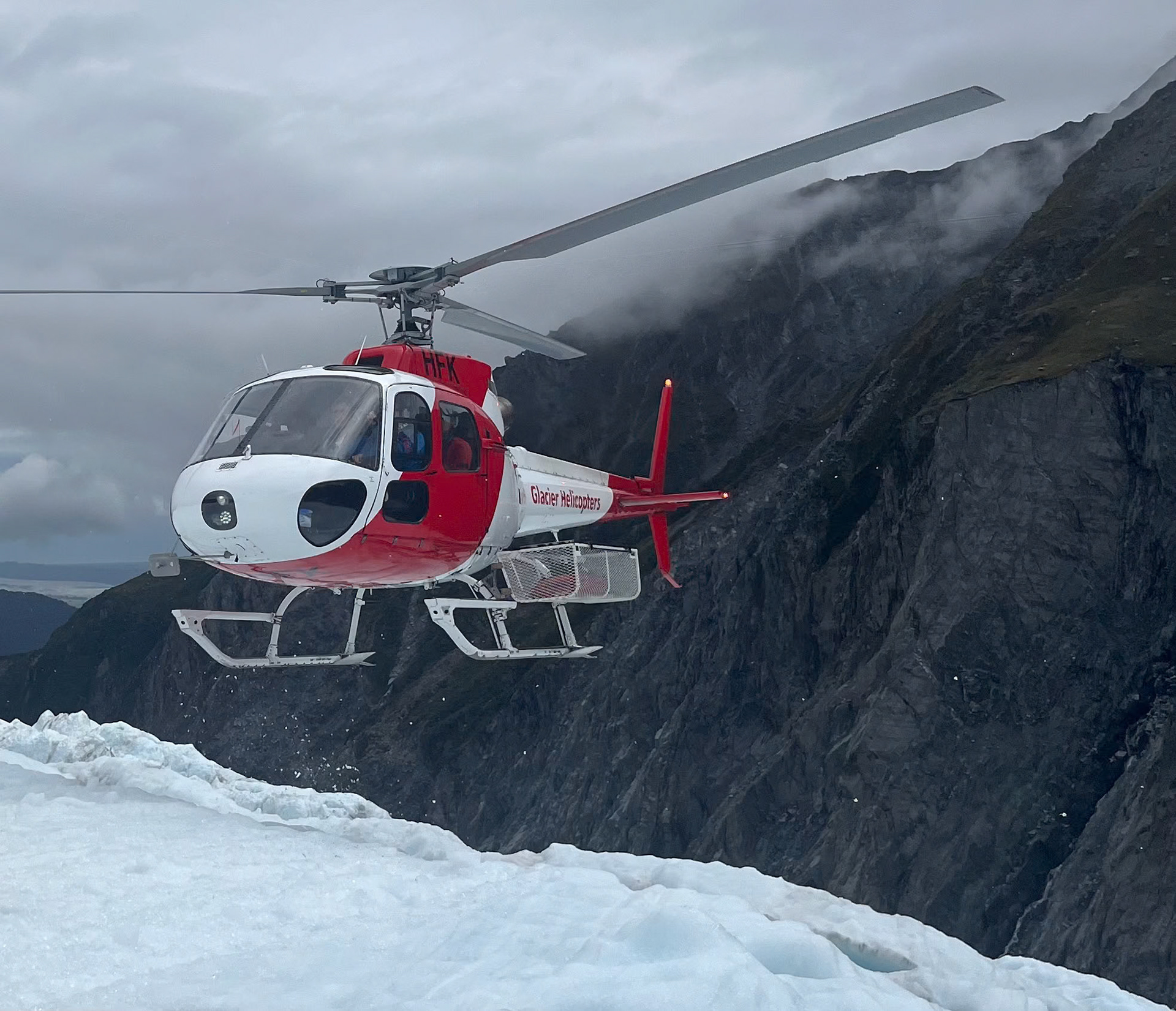
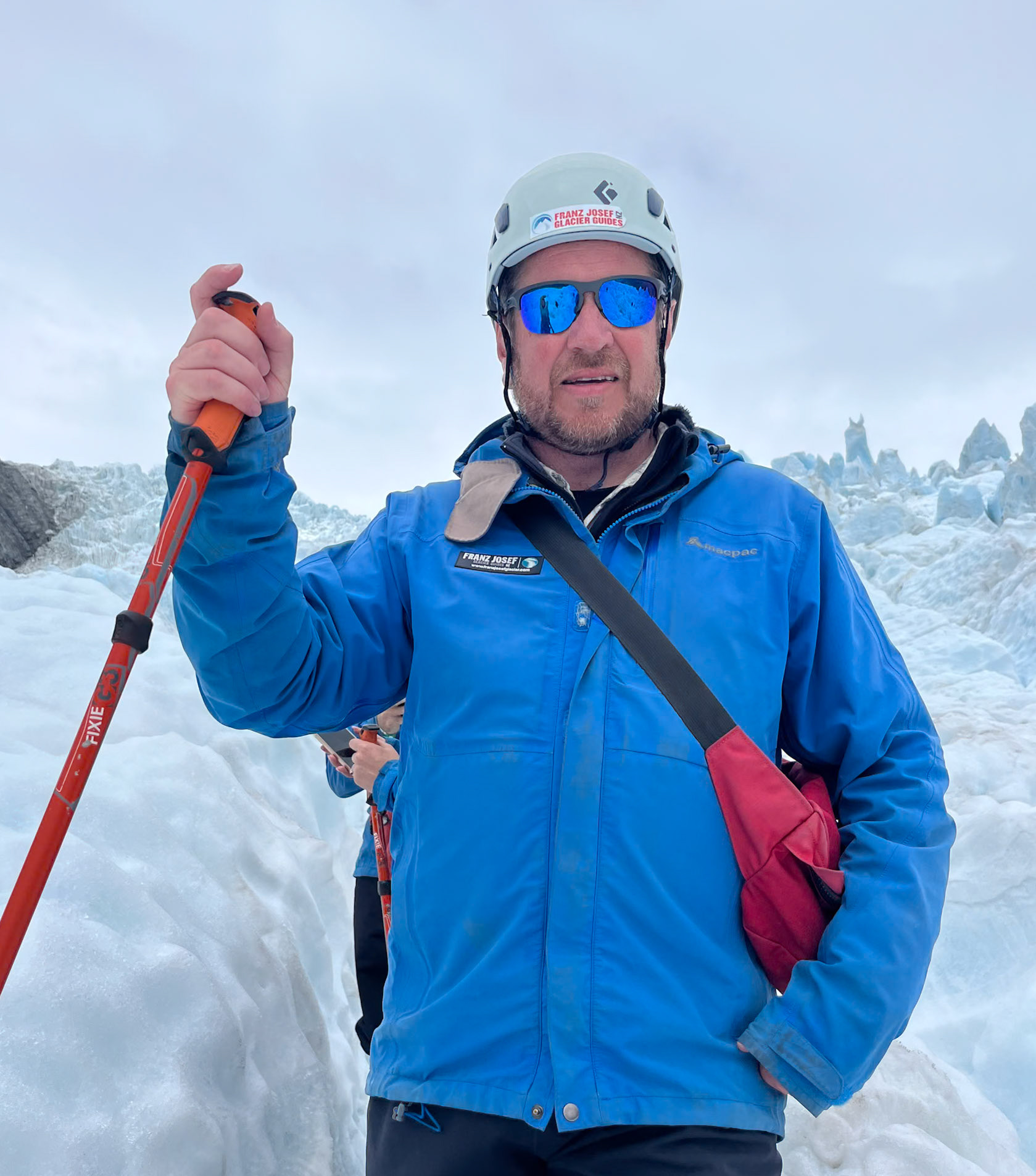
The next day was the day for our scheduled heli-hike. As we drove into Franz Josef, we were very uncertain as to whether the trip would go ahead given the amount of cloud, as well as being more than a little bit nervous about taking a helicopter flight and hiking on glacier. When we arrived, it was still very uncertain as to whether the trip would go ahead, although they started checking people in for earlier flights, and gave the expectation of proceeding as 50:50. When we were waiting in the queue to check in, we met someone who had been due to do the hike the day before, when everything had been cancelled, and who had just packed up ready to go when he thought he would stop to see if there was any chance have a last minute booking. When he got to the front of the queue, he was told that there were two slots on the next trip, but he would need to check in immediately. As he needed to get stuff from the car, this was going to be too soon, so we offered to switch trips to go on the earlier trip, with him and his wife taking our slot on the later trip. This is what we did, which gave us less time to get nervous, and, as it turned out, the better weather.
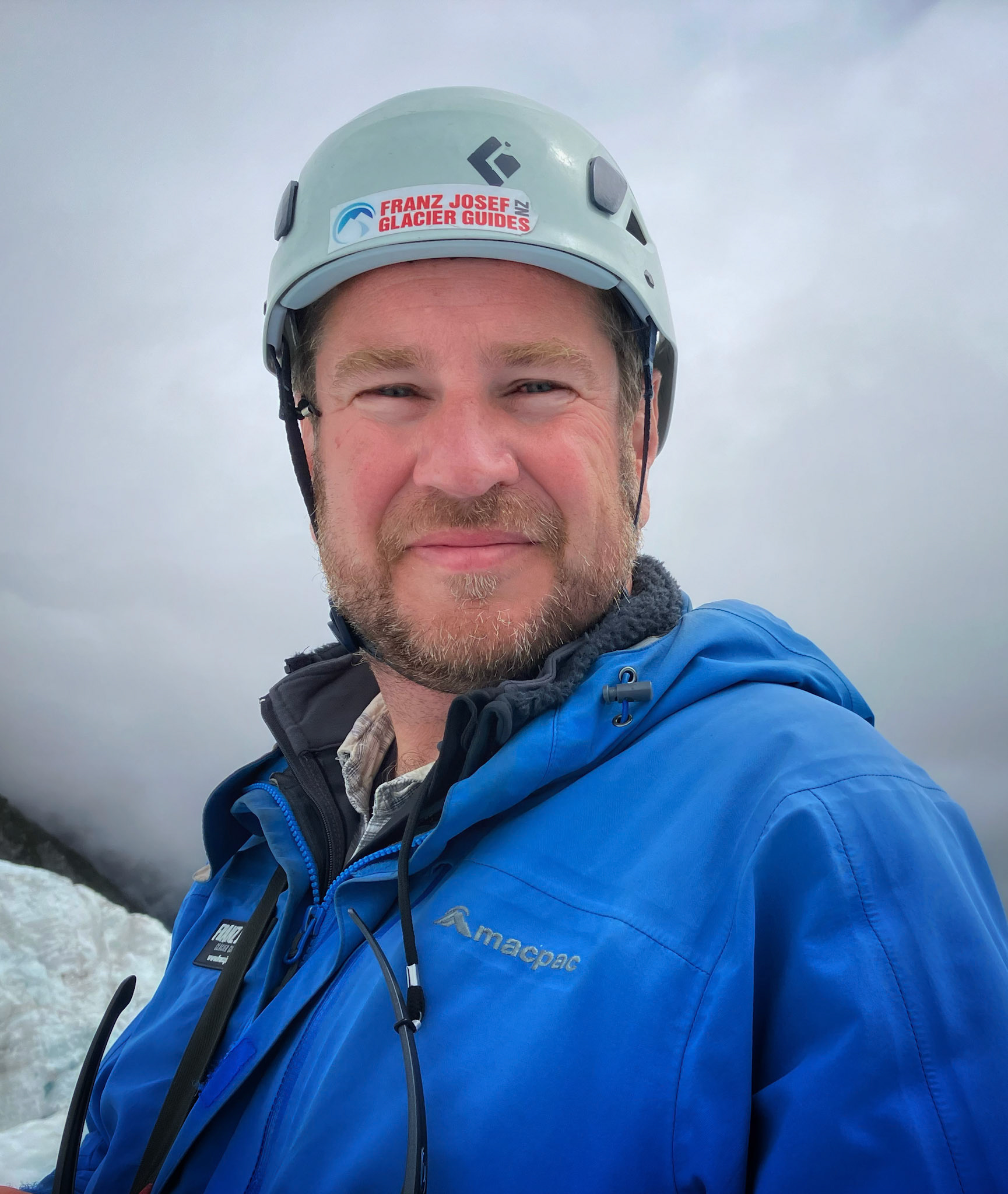
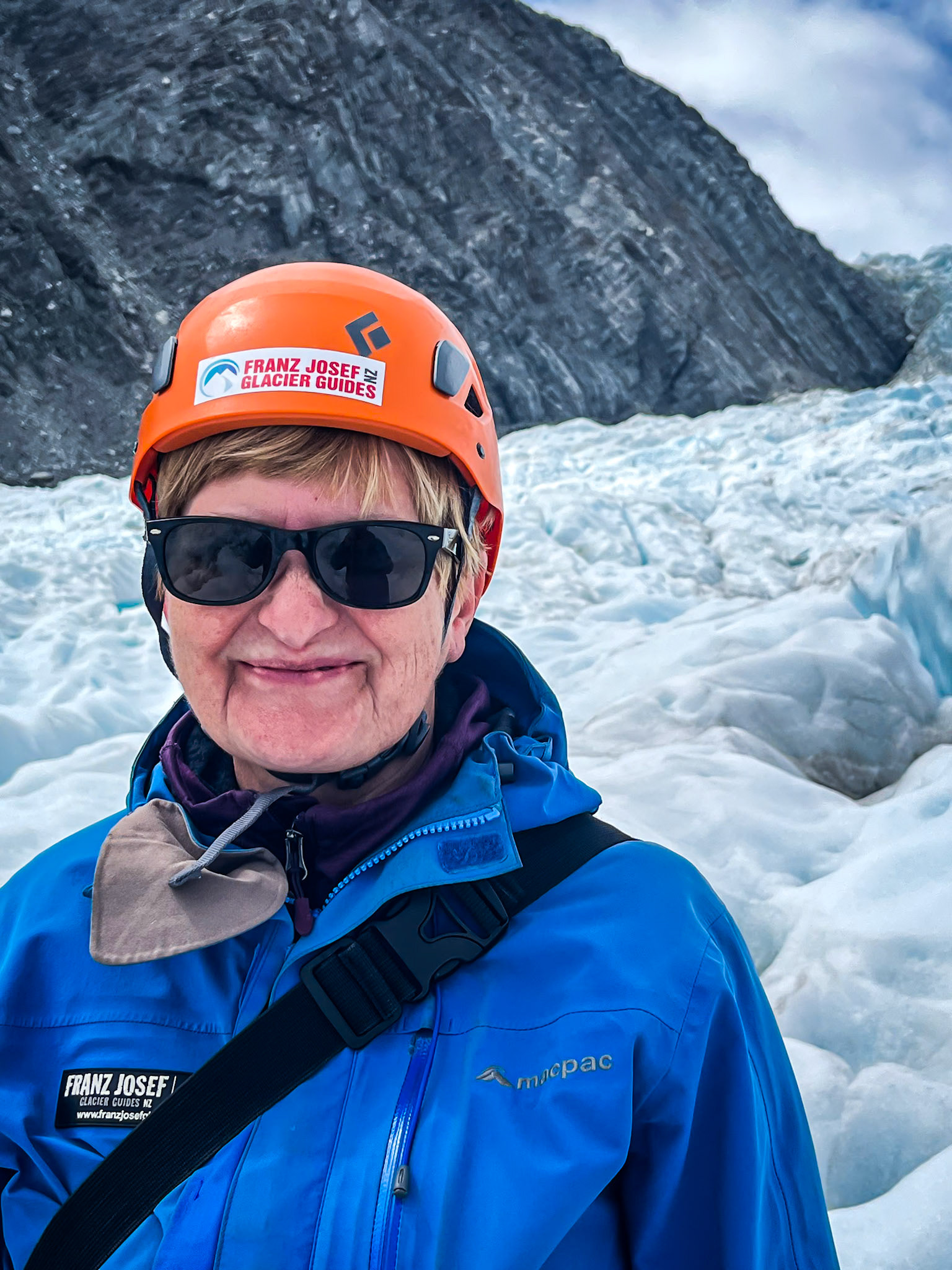
It still took some time from checking in to leaving. First we had to go through various medical questions, and it had to be checked whether Teresa's plate in her ankle and asthma were going to be a problem. We then had to get dressed up in our warm clothes, get our boots, jackets and crampons, go through a safety briefing, and then walk to the helipad.
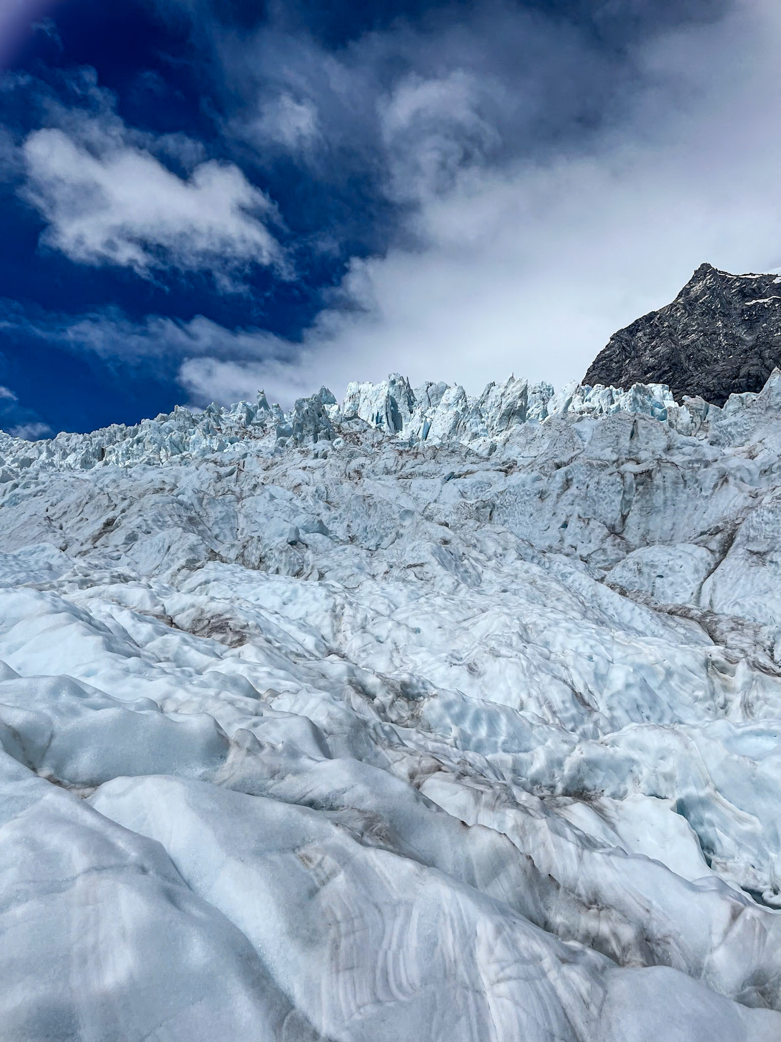
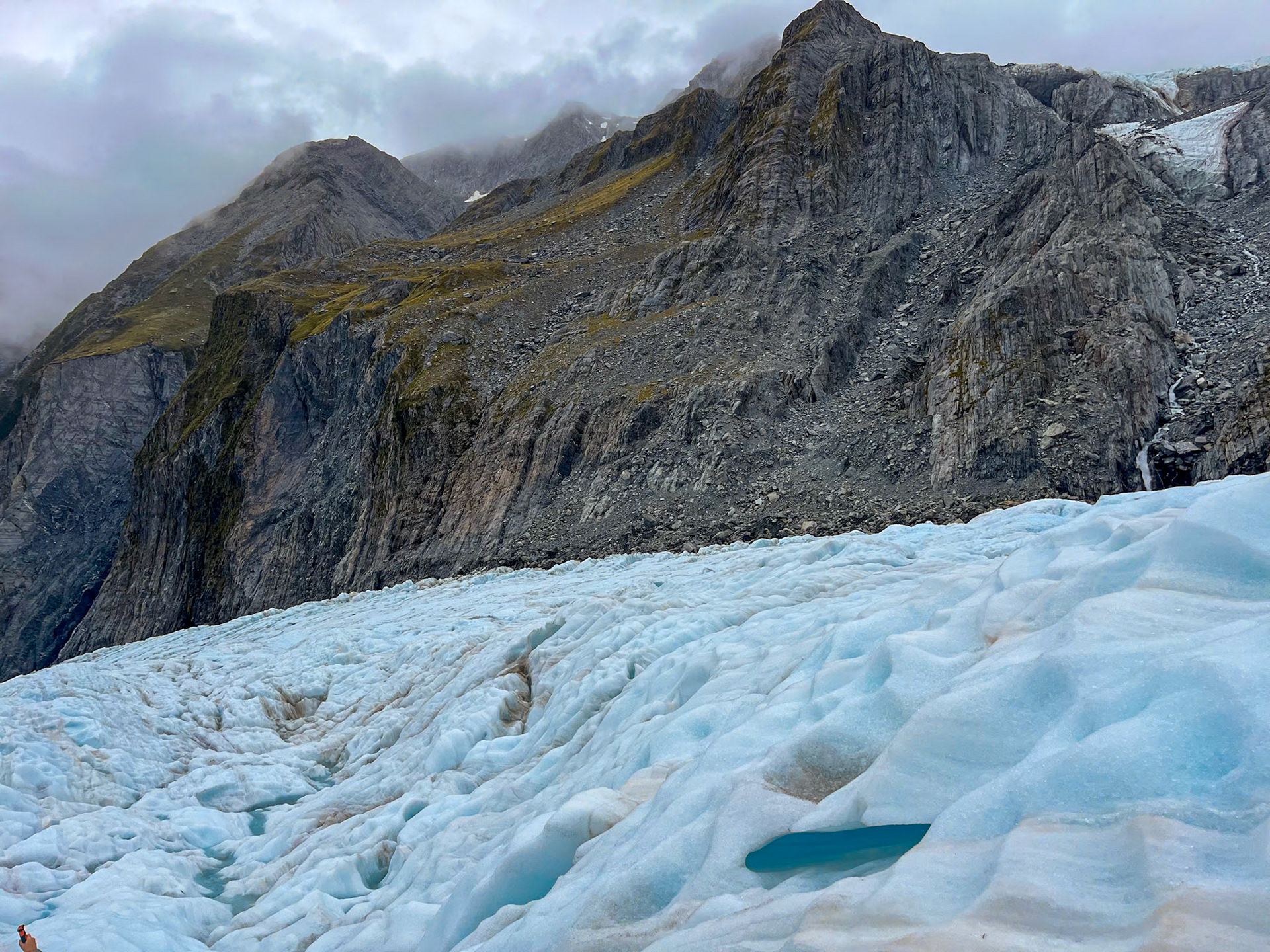
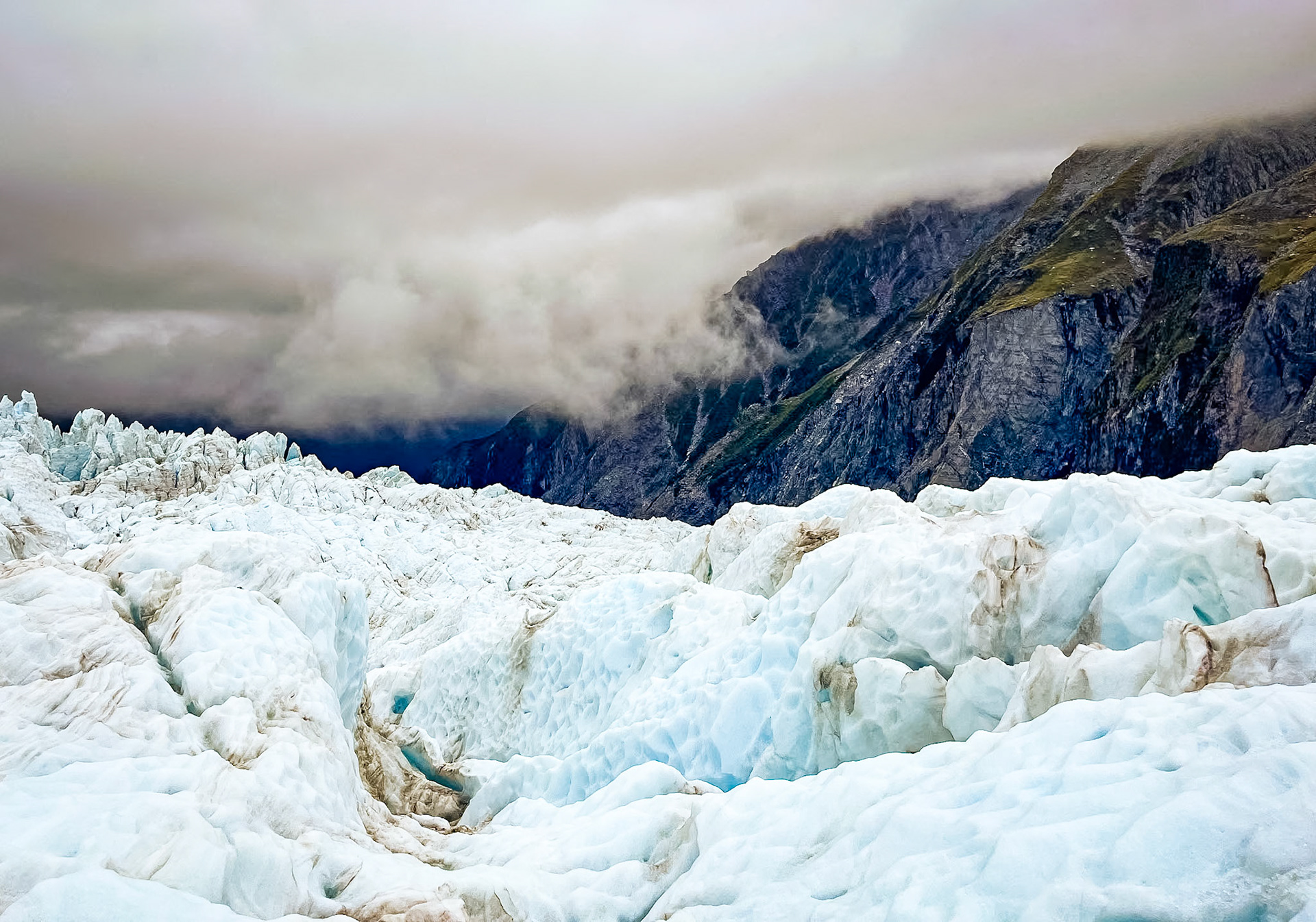
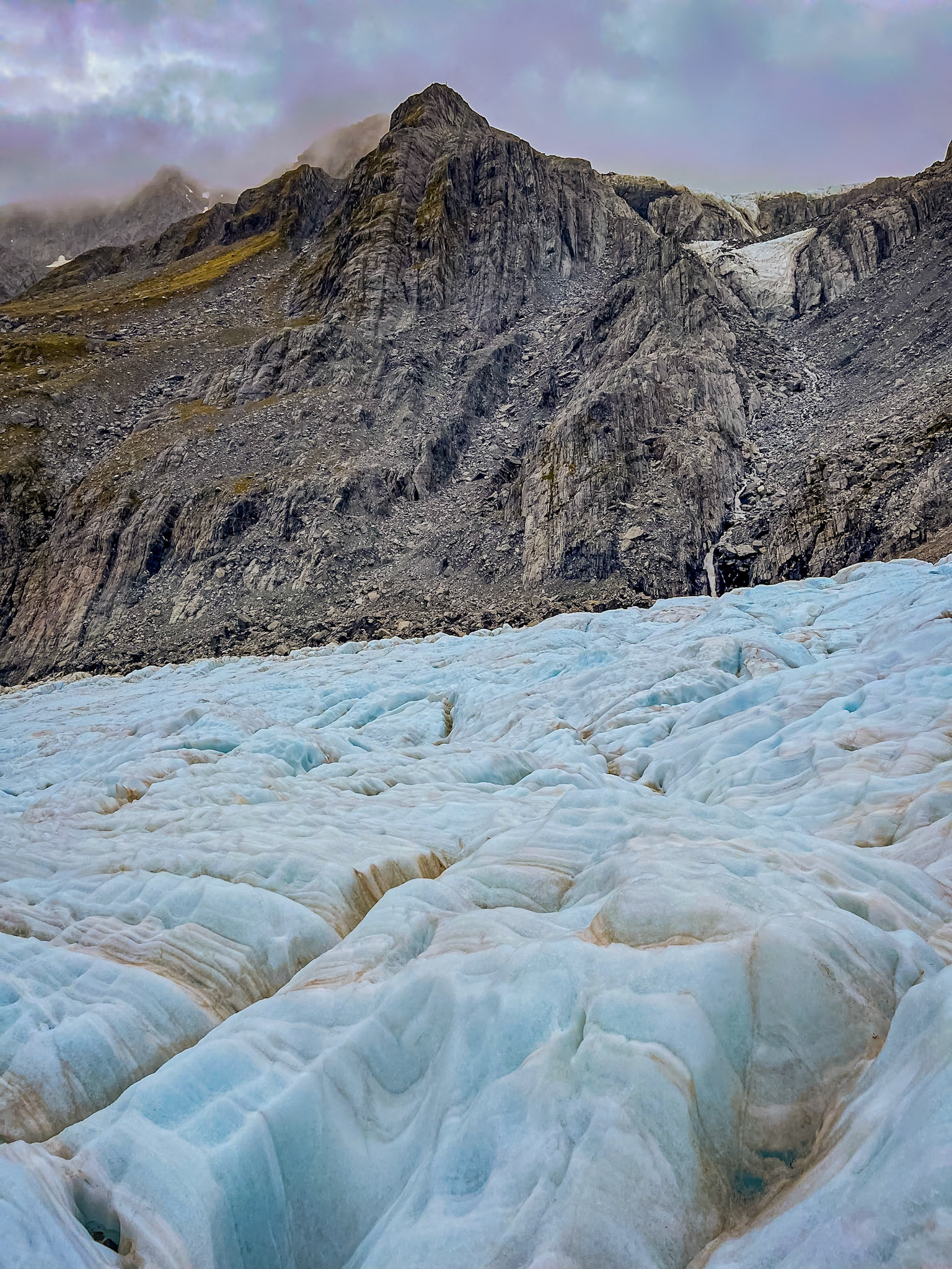
There were six of us in our helicopter, with five in a second helicopter to form a group of 11. They worked out where everyone needed to sit to properly balance the helicopter, with Teresa getting the front seat next to the pilot. It was then a case of jumping into the helicopter as quickly as we could, lifting off and having the 7 or 8 minute flight to land on the ice on the glacier. When we got off the helicopter, put on our crampons and helmet and grabbed a stick, and we were then able to start learning how to use our crampons as we walked over the ice. Initial progress was slow, with us all learning how best to dig our crampons into the ice to stay upright, and learning how to avoid the crevices and pools were the ice had melted. There was some bits where the gaps between the two sides of ice that we were walking between were very narrow, and some steep bits, going both up and down, where we were glad of our poles, and in some cases of ropes that had been put along the pathway to help keep our balance. Where the ice had melted, forming pools of water, the pools were extremely blue in colour, as was the sides of the ice in the various holes and crevices that had opened up in the ice flow.
After about an hour on at the ice, the mist started rolling in, and the guides were clearly getting a bit anxious. Some of the groups behind us, presumably including the group that we were originally scheduled to be in, had to turn round, and we were encouraged to move quickly on as they were trying to bring the helicopters in earlier to get us off the glacier before flying became impossible. It ended up almost like an emergency evacuation, with none of us really wanting to spend the night on the glacier, as nice as it was. When we got to the landing pad, in reality just a relatively flat piece of ice, and saw the helicopter come in, we were all very happy to take off a crampons and helmets, stow these and jump onto the helicopter for the ride back to town.
The experience was almost indescribable, clearly one of the highlights of our trip.
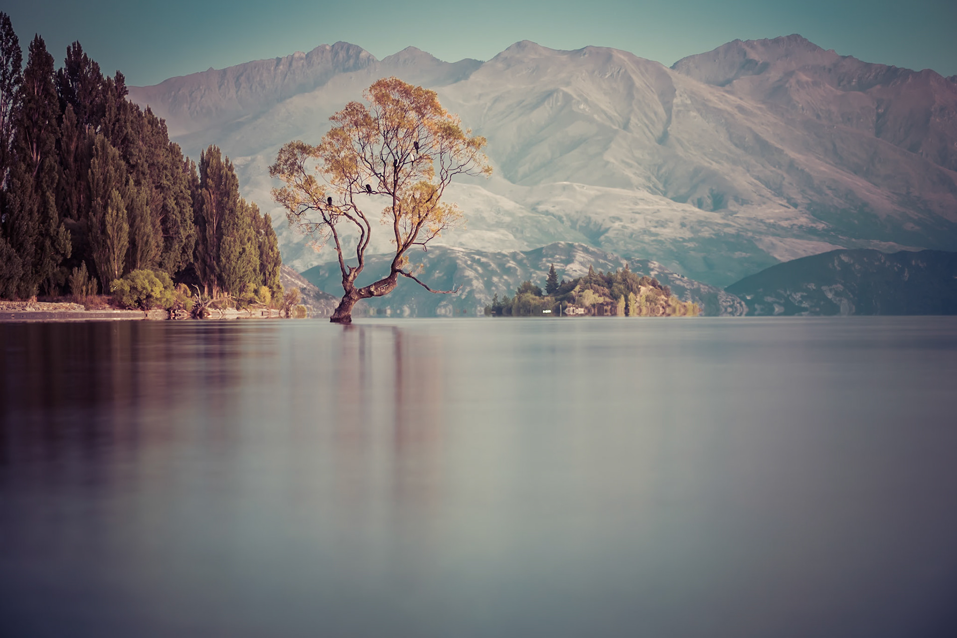
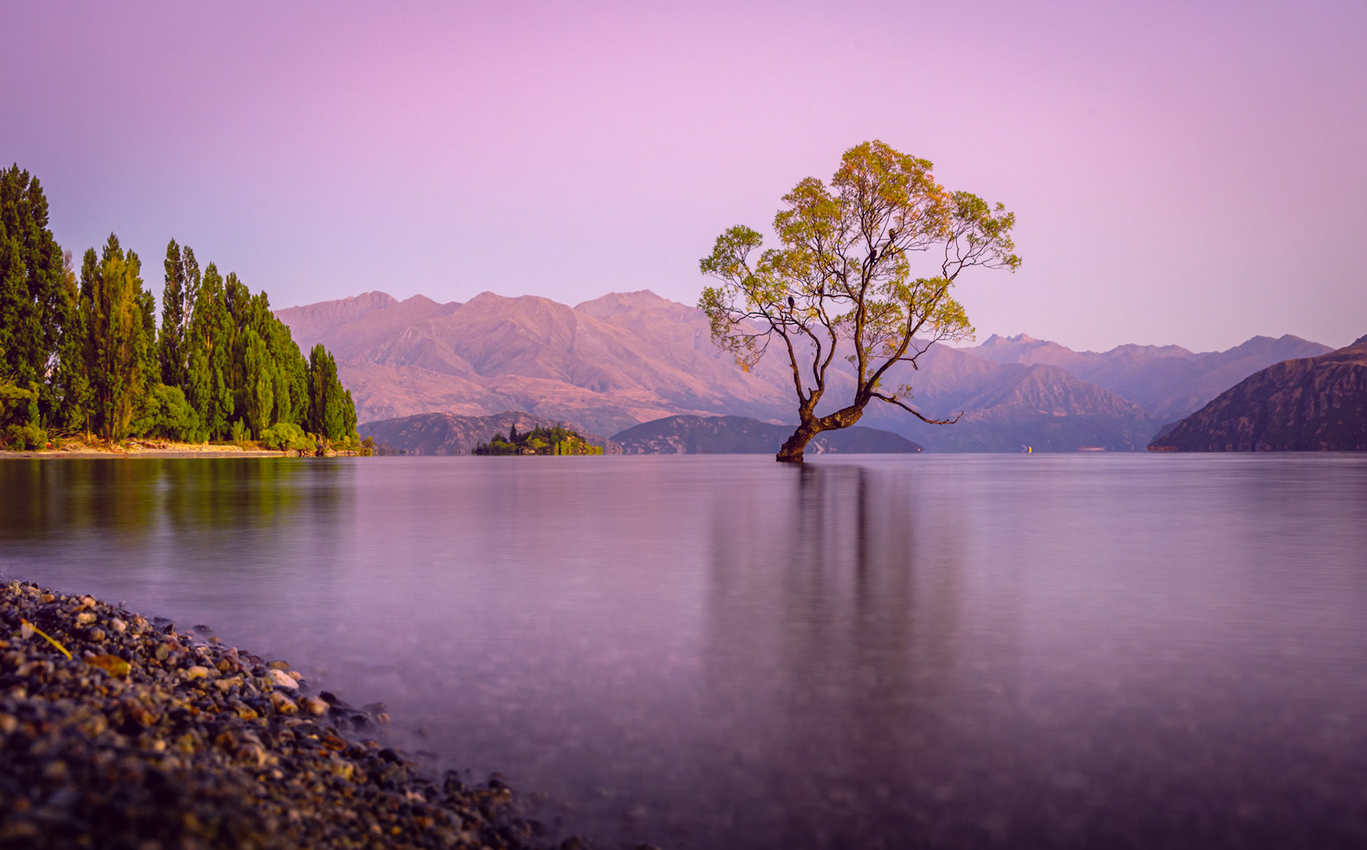
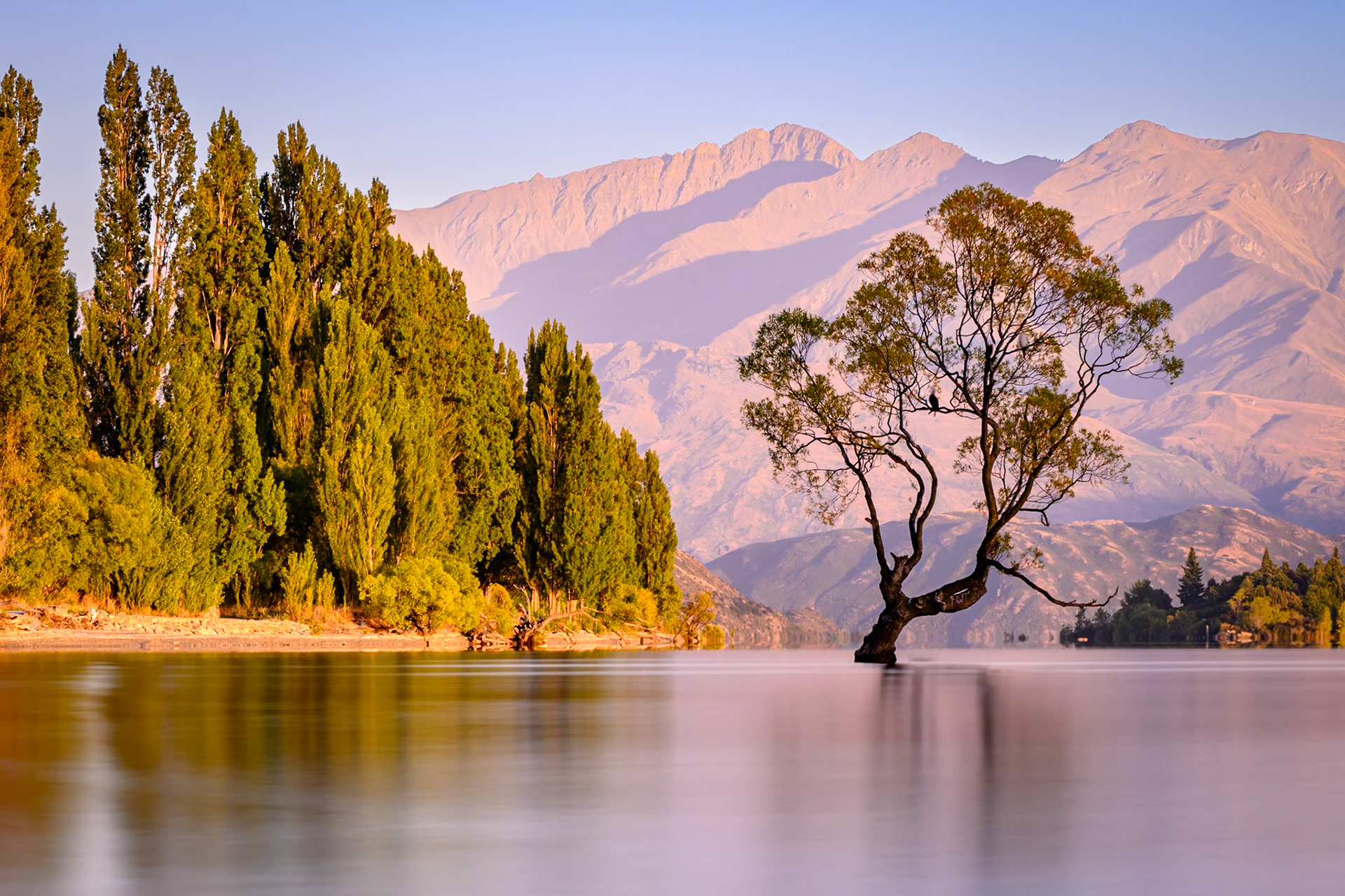
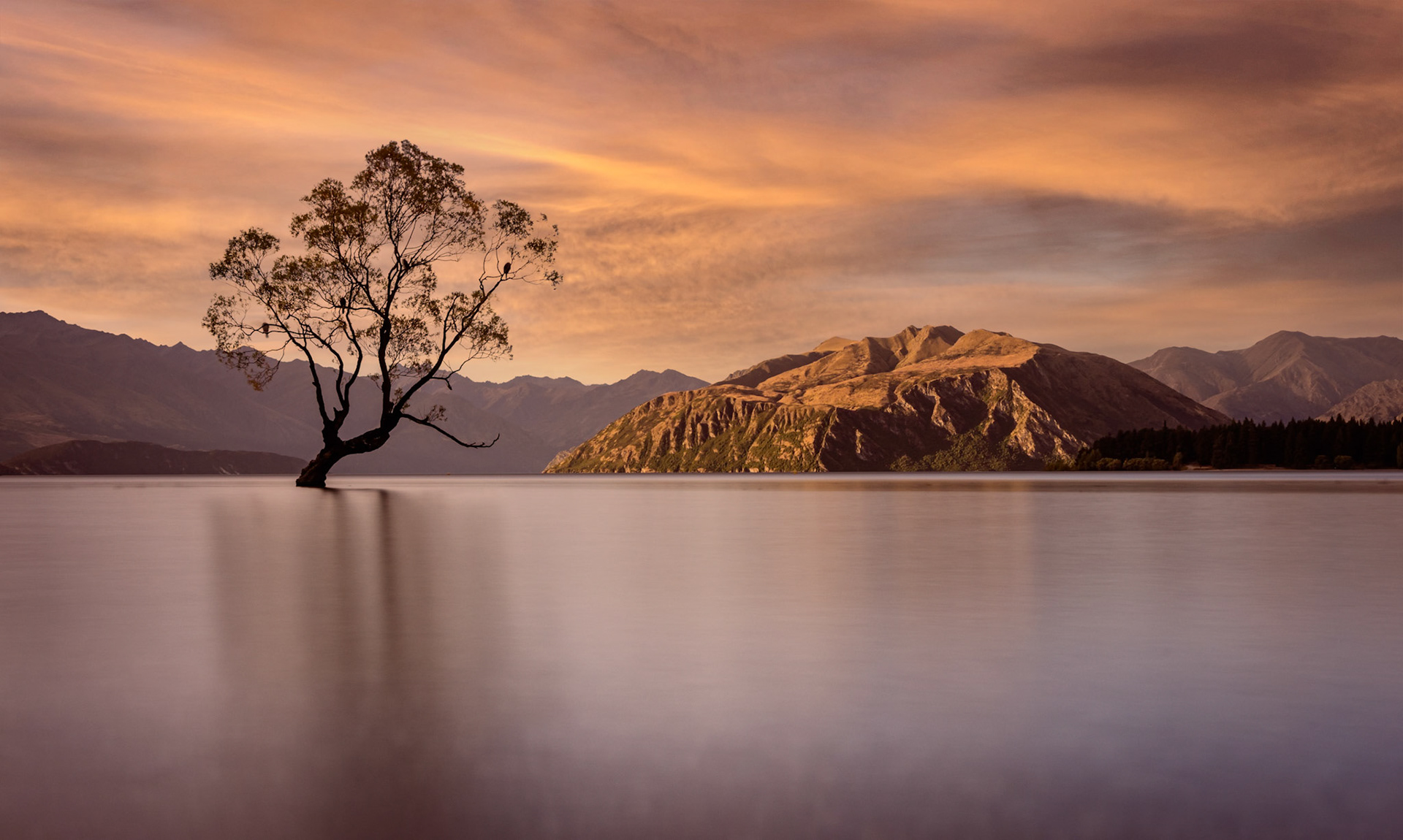
From Franz Josef, we headed south and then east to Wanaka. We did have a slight issue with finding our accommodation in Wanaka. For some reason, the Airbnb address that we had for the accommodation listed the house number and street name of the owners’ previous house in Auckland, a ferry crossing and many miles away. Fortunately, we had some GPS coordinates for the house, and so were, eventually, able to find it. As by this stage it was getting close to sunset, we made the short drive into Wanaka in the hope of getting a photo of the matched photographed Wanaka tree, a tree that is actually in the lake, with the mountains in the background. As we drove into Wanaka, we saw the lake, and so parked at the first opportunity and thought we would take a walk to the tree. As it turns out, the lake is big, being over 30 miles longer. We walked down to the lakefront, but could not see any tree in the lake. After some looking, we saw not the tree but loads of people on the beach clearly taking a photograph of a tree, and so walked along the lakefront and spent far too long taking pictures of the tree. There were quite a lot of people around, together with a drone that insisted on flying through every shot, and so I decided to get up early the next morning and take some more shots at sunrise. This was generally much better as there were very few people around, and much less wind so during longer exposure shots, the leaves on the tree did not move as much. I still do not know which of the various shots of the tree I like the best – so here are a few.
Our accommodation was actually in Albert Town, a few minutes from Wanaka itself. The Airbnb hosts had suggested that a nice, but strenuous, walk was up Mount Iron that was just behind the accommodation. We therefore did this walk which, as suggested, was quite steep in parts, but gave a lovely view over the various lakes and to see into the mountains. From here we went back into Wanaka itself, booked an afternoon cruise on the lake with a short walk on Stevenson's Island at the other end of the lake, and I managed to get my haircut.
After Wanaka, we were heading into our final full week in New Zealand right at the south of the island. They started with a very long drive, through some of the less interesting countryside that we had seen in New Zealand, not helped by the rain, to the Catlins where we would, hopefully, start the nature part of our New Zealand trip.